Bathymetry
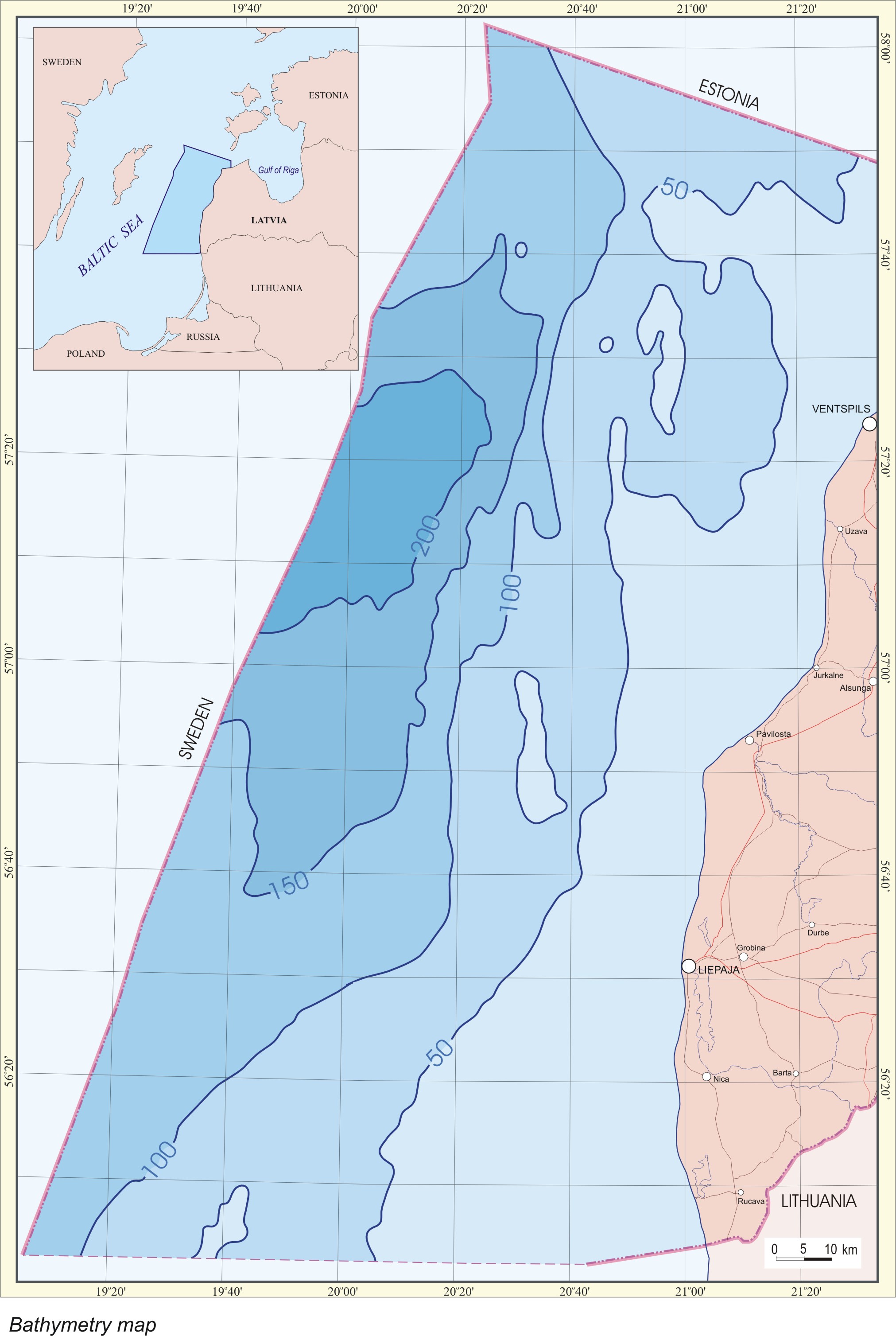
The
maximum water depth in the Latvian offshore area reaches 240 m, however
about 60% of the Latvian sector of the Baltic proper is less than 100 m
deep.
A
bathymetric map is available (Offshore Latvia), scale 1:250 000,
prepared based on the echosounding data obtained during seismic surveys
in 1976-1991. The step of the map isobaths is 10 m.
The
available map formats: