 | |
 |
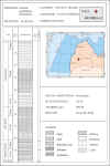
WELL
KULDIGA-2
The
Kuldiga-2 (or Kuldiga R-2) exploration well was drilled in 1965 in the
dome part of the Kuldiga structure with the purpose of detailed testing
of the M. Cambrian oil-bearing horizon.
An oil flow was obtained during the testing of the M. Cambrian sandstone
– 3.3 m3/day. Oil saturation of different intensity was
observed in the core material from the oolitic limestone of the U.
Ordovician age and organogenous-detrital limestone of the M. Ordovician
age.
The well depth is 989 m with the bottom hole in the top M.
Cambrian. |
WELL
KULDIGA-2 GENERAL DATA
|
LOCATION
|
Latvia, onshore
|
|
STRUCTURE
|
Kuldiga
|
|
LATITUDE (WGS-84)
|
56o50’45.2”
|
|
LONGITUDE (WGS-84)
|
21o32’47.3”
|
|
X-LKS92
|
350356.0
|
|
Y-LKS92
|
6302914
.0
|
|
X-UTM
(E), ZONE 34N
|
533333
|
|
Y-UTM
(N), ZONE 34N
|
6300366
|
|
SPUD CLASSIFICATION
|
Prospecting
|
|
OPERATOR
|
Latvian Geological Directorate
|
|
ELEVATION OF ROTOR, m
|
28.89
|
|
ELEVATION OF GROUND, m
|
3.2
|
|
TD (DRILL), m
|
989
|
|
TD (LOG), m
|
977
|
|
TD (VERTICAL), m
|
989
|
|
RIG TYPE
|
Fixed, ZIF-50Br
|
|
SPUD DATE
|
22-Aug-65
|
|
TD DATE
|
30-Sep-65
|
|
COMPLETION DATE
|
20-Mar-64
|
|
OBJECTIVE HORIZON
|
M.Cambrian
|
|
AGE OF ROCK AT BOTTOM
|
M.Cambrian
|
|
AGE OF PAY HORIZON
|
|
Well
data are available to the oil industry for purchase and inspection.
Kuldiga-2
well data package includes:
|
GENERAL DATA
|
|
BIT SIZE
|
|
CASING
|
|
LOG DATA in LAS format
|
|
CORING
|
|
STRATIGRAPHY
|
|
CONVENTIONAL CORE DECRIPTION
|
|
TESTING RESULTS
|
|
FORMATION WATER COMPOSITION
|
|
OIL PROPERTIES
|
|
OIL FRACTIONATION DATA
|
GAS PROPERTIES
|
|
GAS CHROMATOGRAPHY
|
|
GAS CHROMATOGRAPHY - MASS SPECTROMETRY
|
| GAS CHROMATOGRAMS AND ION TRACES m/z191&m/z217 |
| TEMPERATURE DATA |
General
information about well logging, coring, casing, testing - see Kuldiga_2_logging_test.pdf
©
LATVIJAS VIDES, ĢEOLOĢIJAS UN METEOROLOĢIJAS CENTRS
©
LATVIAN ENVIRONMENT, GEOLOGY AND METEOROLOGY CENTRE
|


