 | |
 |
Offshore
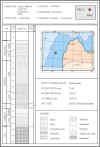
well: P6-1
P6-1
well was drilled in 1988, in the central part of the Latvian
offshore area ca 60 km to NW of Liepaja. Well was drilled to test
drilling equipment and was never regarded as an exploration well.
It is truly a stratigraphic well, located off-structure.
Oil
shows were observed within the Ordovician succession. |
General data
|
Location
|
Field
|
Spud
classification
|
Operator
|
Elevation,
m
|
TD
(drill),
m
|
Rig
type
|
TD
date
|
Age
of rock at bottom
|
Water
depth,
m
|
|
Baltic
sea
|
|
Stratigraphic
|
Arctic
offshore Oil & Gas
Exploration
Trust, Russia
|
22.4
|
1835.5
|
MODU
(Semisubmersible)
|
1988
|
Pre-Cambrian
|
120.6
|
Coordinates
|
Latitude
(Krasovsky
1940)
|
Longitude
(Krasovsky
1940)
|
Latitude
(WGS
84)
|
Longitude
(WGS-84)
|
X-UTM
(E)
Zone
34N
|
Y-UTM
(N)
Zone
34N
|
|
56o50’44”
|
20o14’28”
|
56o50’43.237”
|
20o14’20.672”
|
453584
|
6300427
|
Available
data
|
P6-1
well data package includes: |
|
GENERAL
DATA
|
|
BIT
SIZE
|
|
CASING
|
|
LOG
DATA IN LAS FORMAT
|
|
CORING
|
|
STRATIGRAPHY
|
|
CONVENTIONAL
CORE DECRIPTION
|
|
PETROPHYSICAL
AHALYSIS DATA
|
|
TESTING
RESULTS
|
|
VELOCITY
SURVEY DATA
|
©
LATVIJAS VIDES, ĢEOLOĢIJAS UN METEOROLOĢIJAS CENTRS
©
LATVIAN ENVIRONMENT, GEOLOGY AND METEOROLOGY CENTRE
|
